

Coastal Virginia & Outer Banks Layered Map - Customized
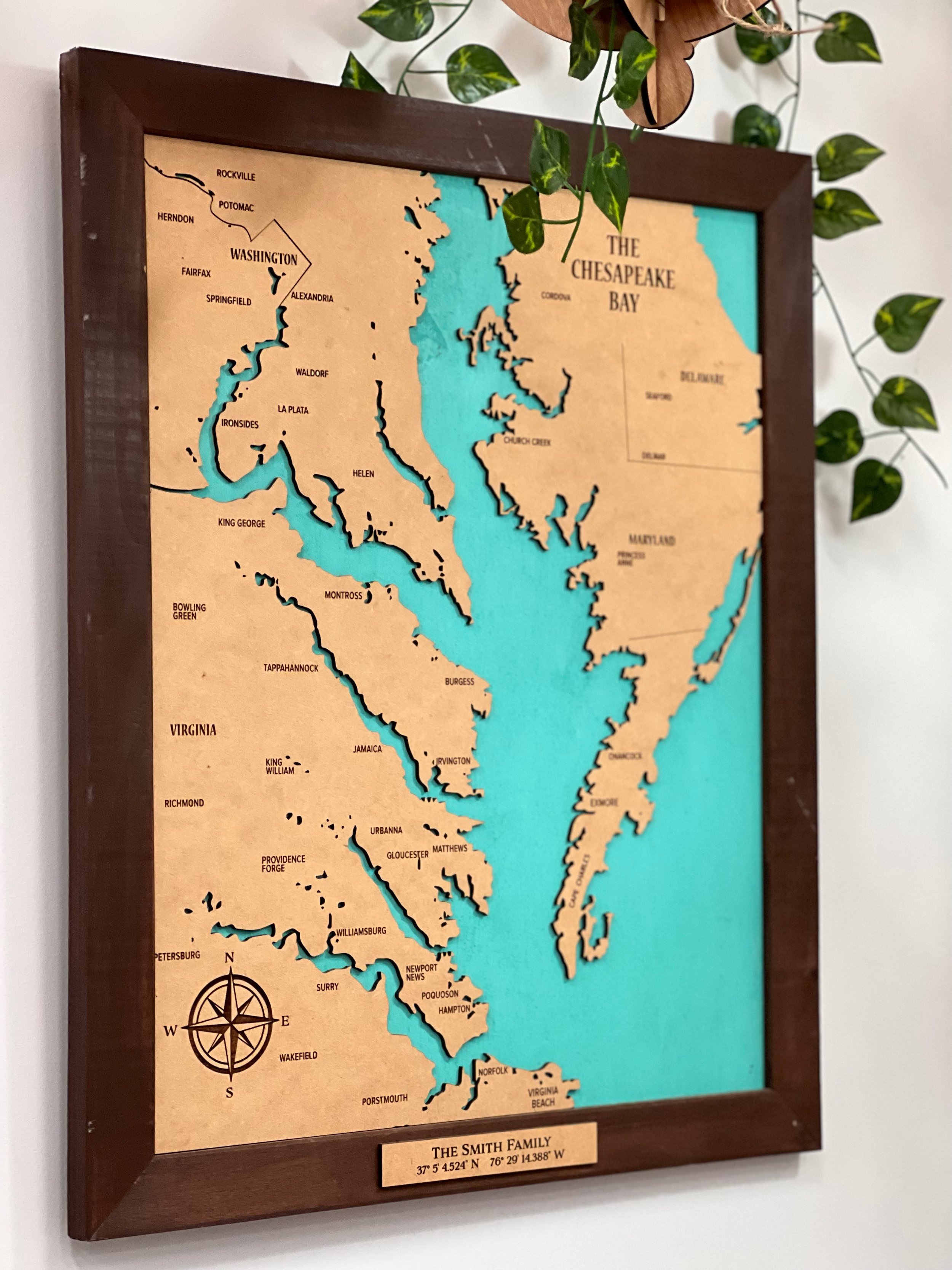
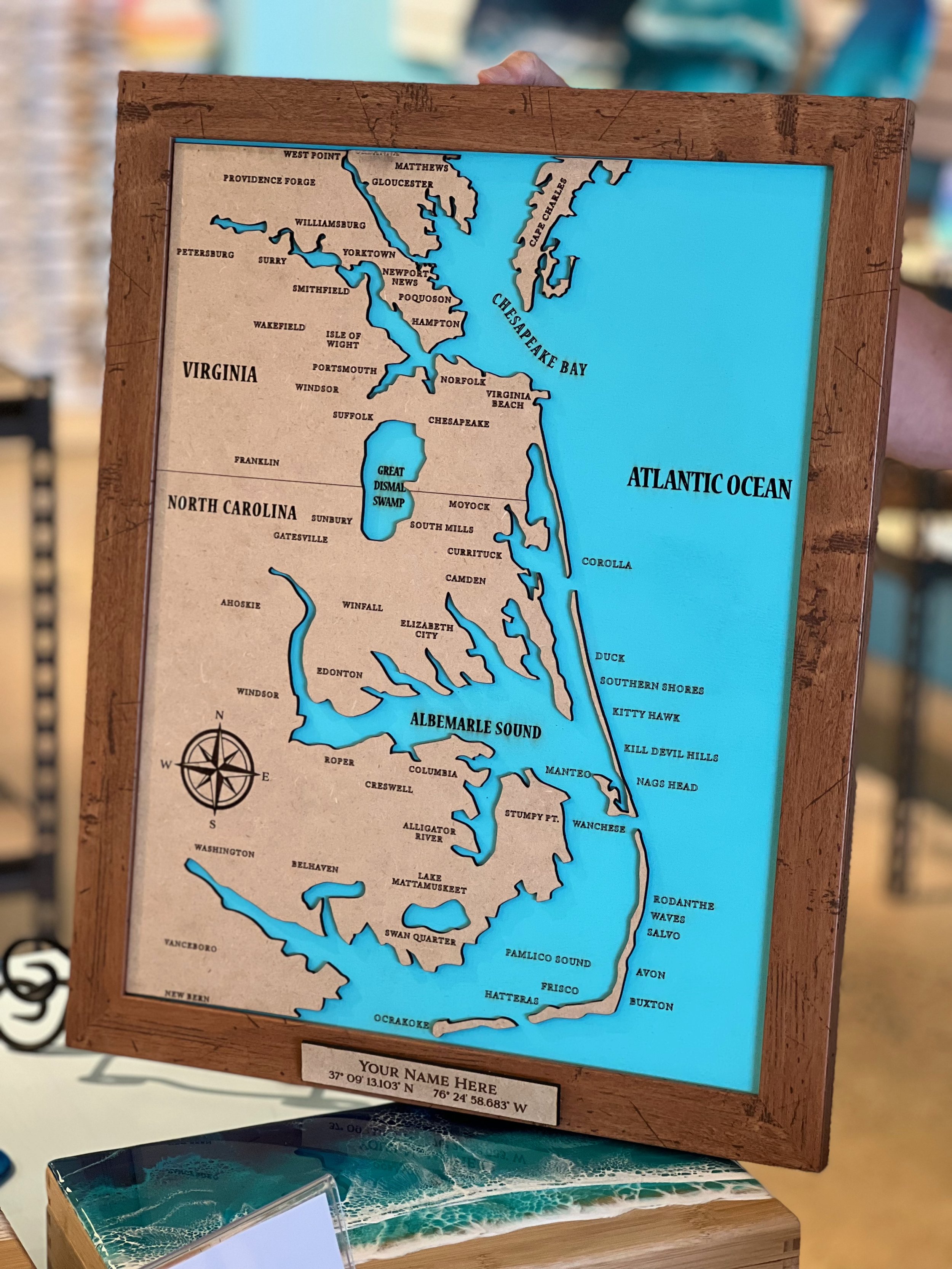
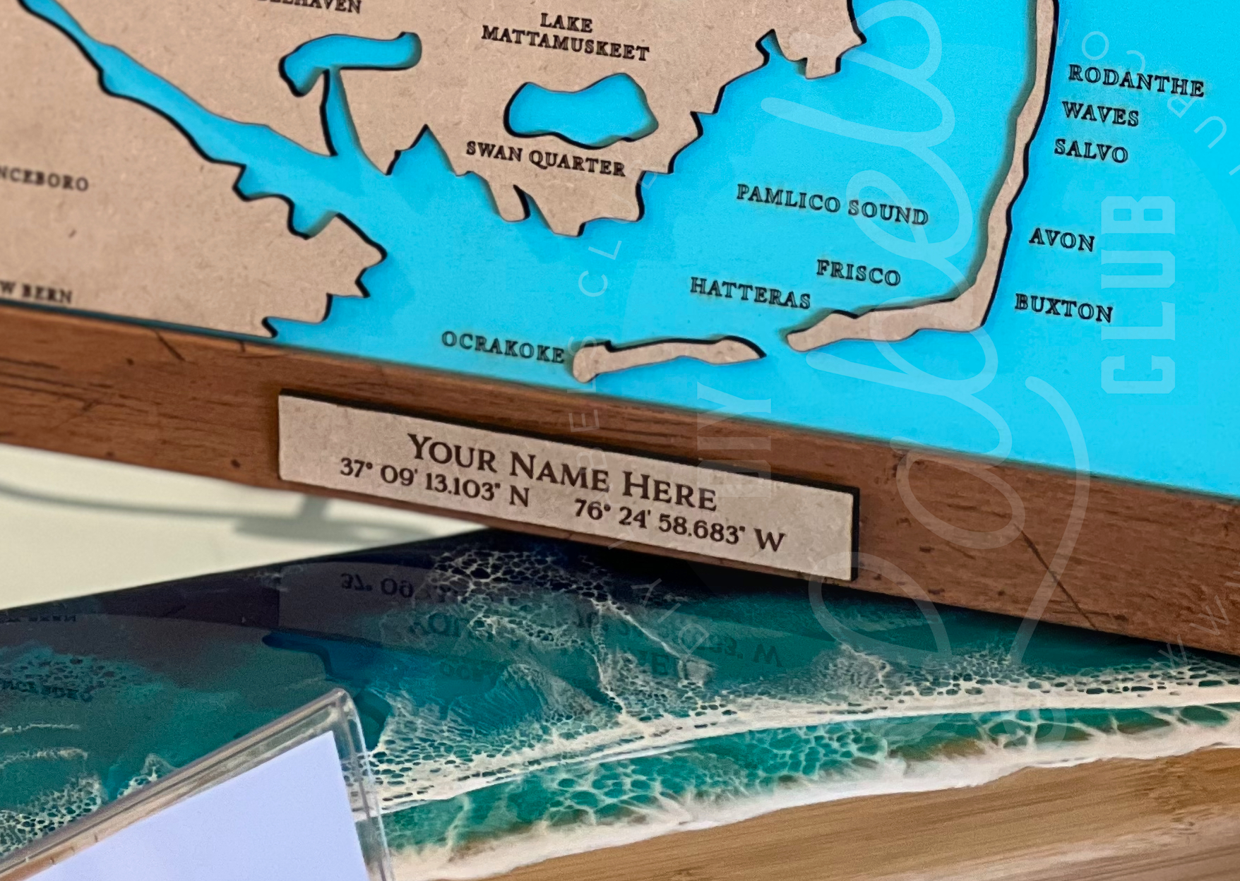
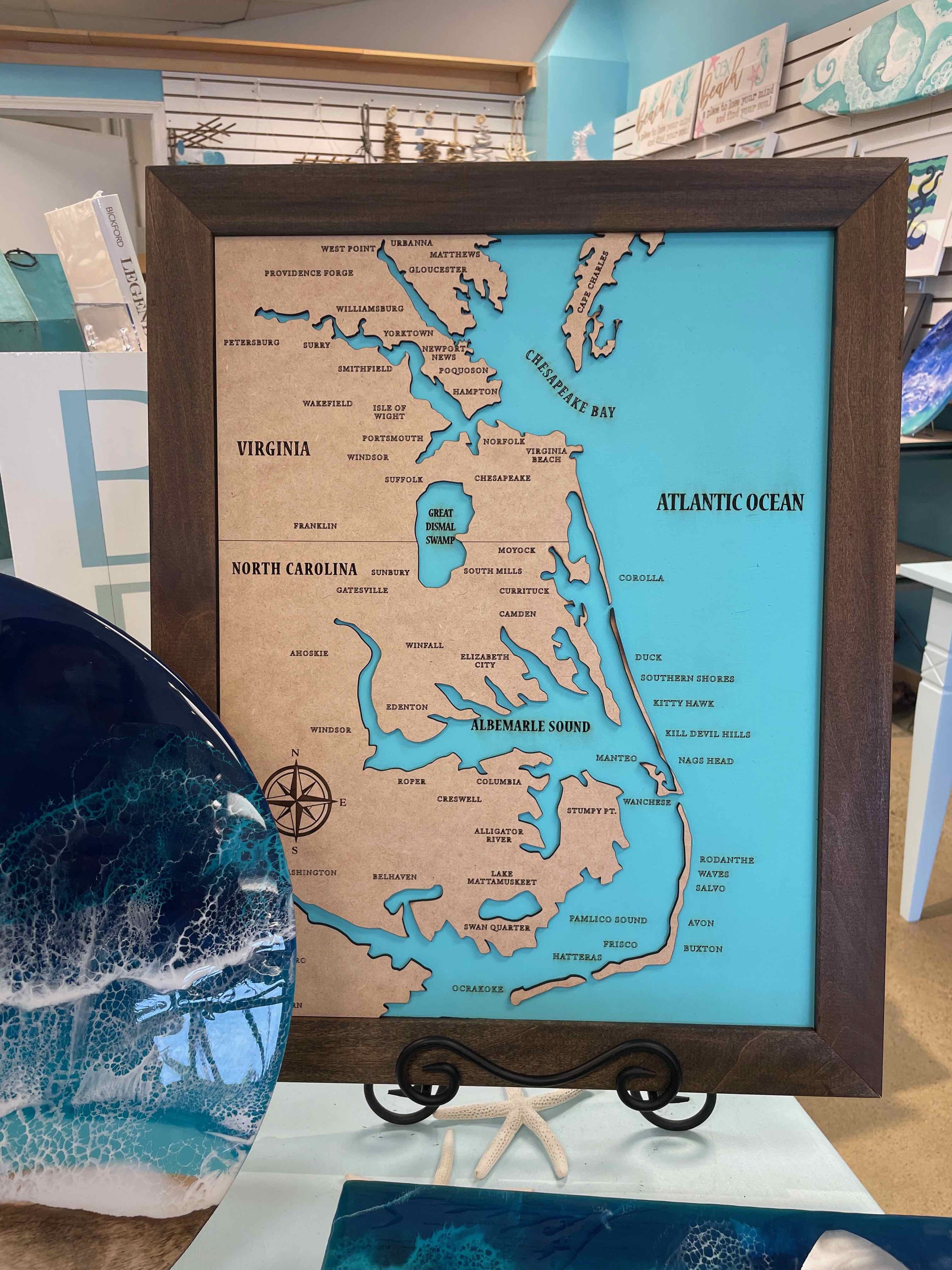
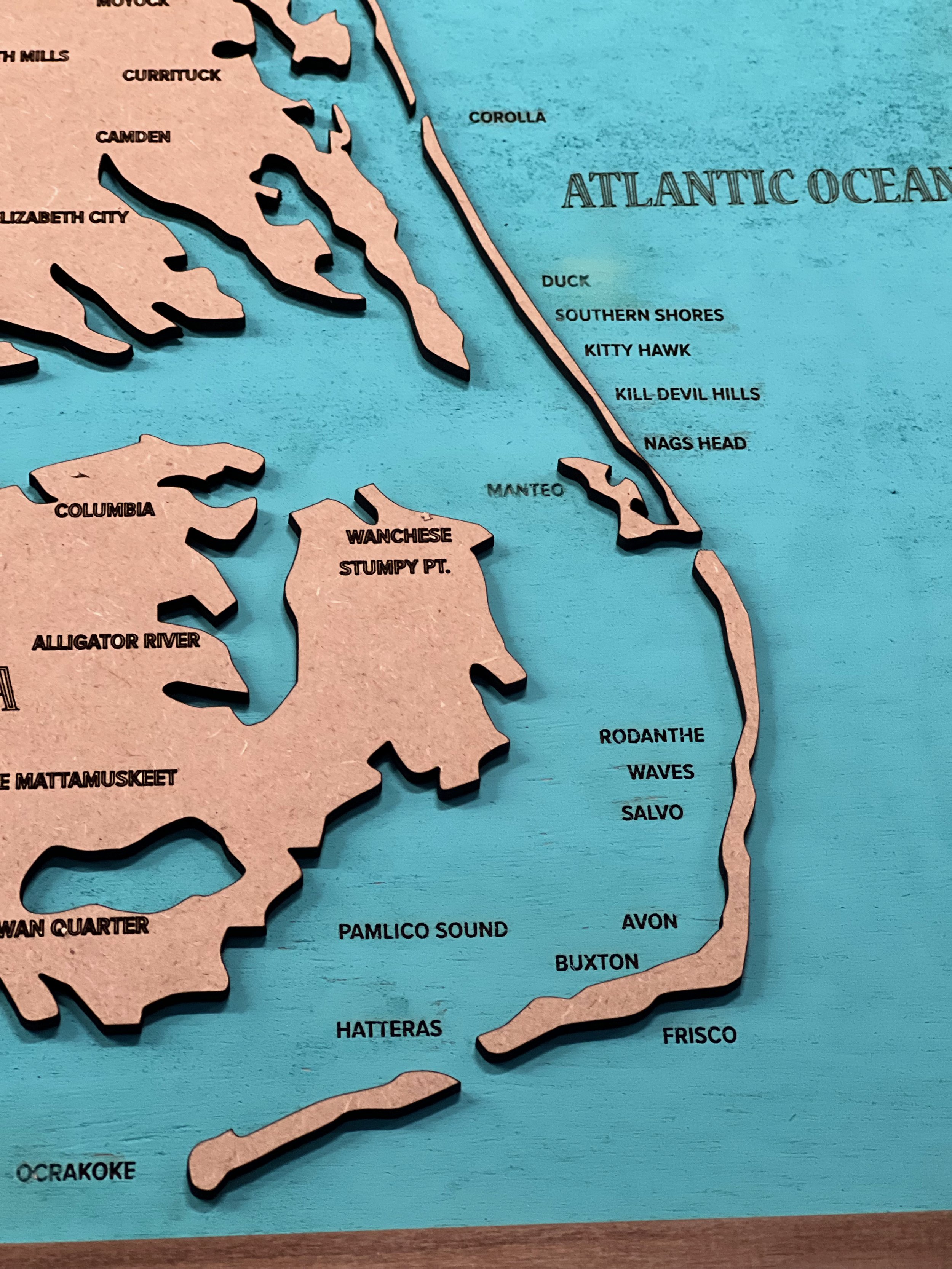
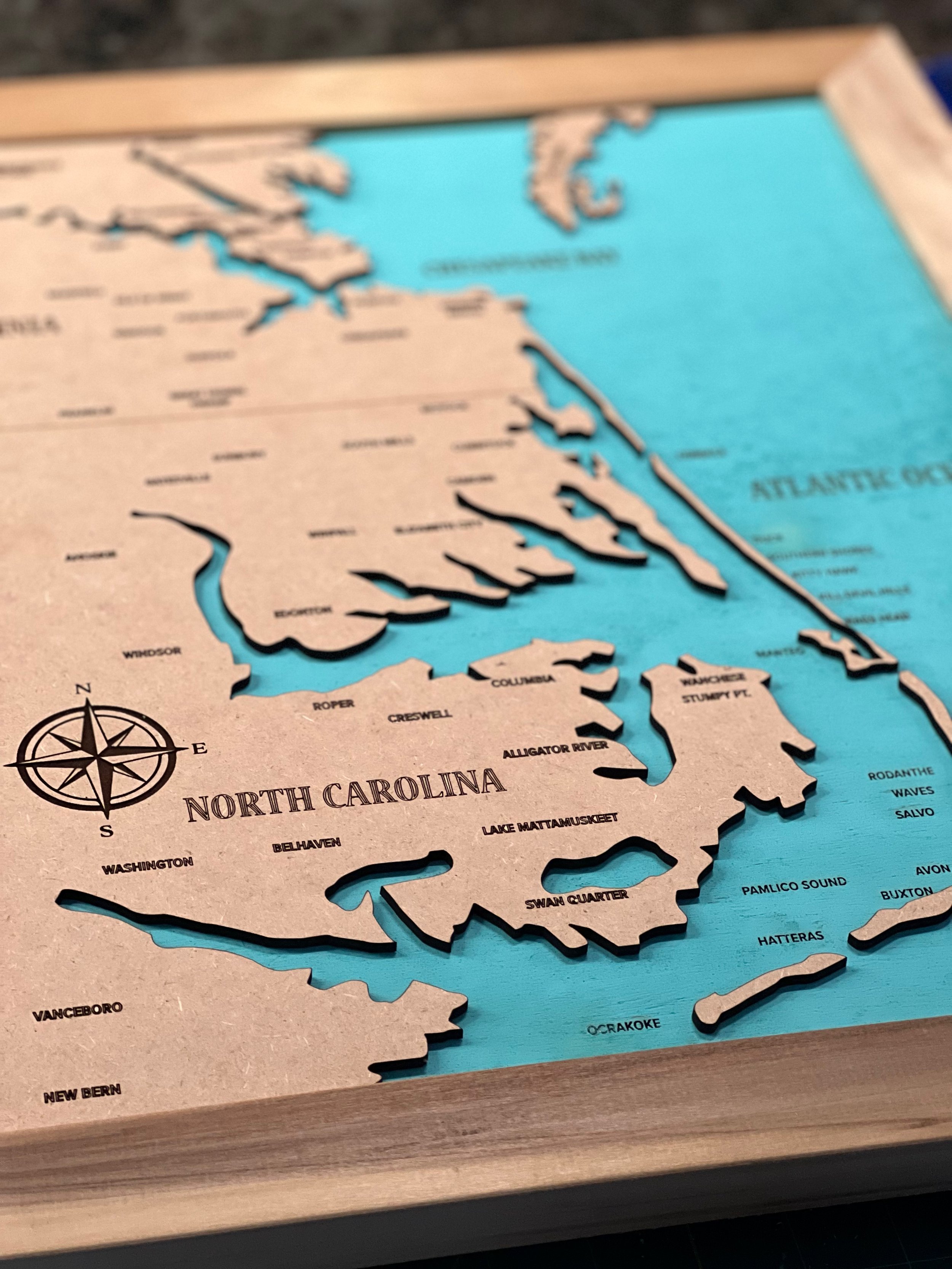
14” x 18” dimensions. Coastal Virginia & Outer Banks Layered Map - this layered map is engraved and cut using a laser machine and showcases the Middle Peninsula, Hampton Roads, Chesapeake Bay and Outer Banks areas. If you live in these areas, or vacation here, you know how special these coastal towns and waterways are! Each map is hand made and has a custom name plate with your family or business’s name and your personal GPS coordinates of choice.
14” x 18” dimensions. Coastal Virginia & Outer Banks Layered Map - this layered map is engraved and cut using a laser machine and showcases the Middle Peninsula, Hampton Roads, Chesapeake Bay and Outer Banks areas. If you live in these areas, or vacation here, you know how special these coastal towns and waterways are! Each map is hand made and has a custom name plate with your family or business’s name and your personal GPS coordinates of choice.
14” x 18” dimensions. Coastal Virginia & Outer Banks Layered Map - this layered map is engraved and cut using a laser machine and showcases the Middle Peninsula, Hampton Roads, Chesapeake Bay and Outer Banks areas. If you live in these areas, or vacation here, you know how special these coastal towns and waterways are! Each map is hand made and has a custom name plate with your family or business’s name and your personal GPS coordinates of choice.